INESAN (Institut evaluací a sociálních analýz)
Sokolovská 351/25
186 00 Praha 8
Česká republika
Email: info@inesan.eu Tel.: +420 220 190 597
INESAN (Institut evaluací a sociálních analýz)
Sokolovská 351/25
186 00 Praha 8
Česká republika
Email: info@inesan.eu Tel.: +420 220 190 597
mezioborový výzkum
mezioborová platforma

Title: Interdisciplinary design of urban development
number TL01000025
Aim of this project is development of software application-interdisciplinary autonomous interface (software MAR) using large database analysed by an algorithm enabling machine learning. The purpose of the project is to create a virtual space where three thematic areas, e.g. natural sciences/landscape, social and urbanistic/architectural converge and produce data, presented for example in the form of statistics, maps and charts.
The resulting software-interdisciplinary autonomous interface (MAR) enables municipalities to generate outcomes gathered through interdisciplinary approach, that will be readily applicable in processes of complex developmental, strategical and community planning, shaping visions of development of territorial units or tackling problems of towns and cities with tailored solutions. Application of the project’s results contribute to smart urbanism and will have impact on the quality of environment and life in the city.
Beneficiary: INESAN (Institute for evaluations and social analysis)
Provider: The Technological Agency of the Czech Republic
Project manager: Helena Humňalová, MSc. / Mgr. Linda Kovářová, Ph.D.
Members of the team: Ing. Jana Menšíková, Mgr. Jan Šturma, Ing. Arch. Ivo Pavlík, Mgr. Adam Bedřich, Ing. Jan Zivčák
Timescale: 04/2018 – 05/2021
Planned results: software (results R), interdisciplinary reports (O)
Other resluts:
The sprawling urban spaces are current global trend. It contains a lot of problems, from insufficient infrastructure, devastation of nature, unregulated growth of suburban areas, or likelihood of deterioration of social conditions. The development of towns and cities constitute a complex process in a dire need of long-term vision, use of adequate planning tools; a process which essentially ought to be interidisciplinary.
Urbanization is not necessarily a negative phenomenon when dealt with sensitively, with respect to shared values and with positive, long-term sustainable strategy. Our multidisciplinary method provides a robust tool able to achieve that goal.
The life in a suburbia is often strikingly different from a shiny catalog presentations and idealistic visualizations of architectural studios. Centers, pubs and shops are far distant, shady parks or even grown trees are absent in the summer heat and proclaimed “virgin nature” is in reality a thick oil-seed rape field without a single walking path.
Does it sounds familiar to you? Is it a necessary evil of all new development? Is it enough to just reside and be thankful for that?
We argue that it is decisively not necessary. Already existing suburbs can be reshaped and the new ones can be planned in better way.
How do we work?
We approach urban development from an interdisciplinary perspective, which stands for an intersection of social geography, architecture and urbanism, geobotanics, social and cultural anthropology, history, archaeology or economy. Methods used by each of these disciplines stay true to their essence. Consequently they are connected with each other by means of an interdisciplinary interpretative method.
What is different about our approach?
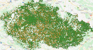
By means of the interdisciplinary interpretative method we connect different disciplines such as anthropology and geobotanics. We use neural networks, geographical information systems (GIS) and statistical analysis to examine and scrutinize publicly available data and data gathered in the field through physical mapping in the area.
1. Software MAR
Open access software MAR (QGIS) supplied with our plugin primarily offers better understanding of the territorial unit in a broader context and leads to smart urbanism. The outcomes may serve as an objective sources of information for development of strategic planning and conceptual materials, as well as a tool for searching potential solutions of specific problems that cities face.
find download link below
2. Interdisciplinary research and analysis
Our interdisciplinary research is able to process complex set of problems and identify links, where other “mono-disciplinary” researches often fall short. We offer alternative solutions in seemingly conflicting situations, such as the need for a new housing development while retaining high quality of local natural environment. Our analysis is twofold – the first level Is of general nature and deals only with publicly accessible data sets. The second level contains an intensive fieldwork. Finally we provide an analysis based on the detailed synthesis of data from fieldwork and publicly accessible data sets. Final product of our survey, besides the analysis itself, is a series of graphs, maps and visualizations of proposed solutions of specific places illustrating our findings.
for more information contact INESAN
3. Architectural analysis and fast sketches
Architectural studio City Upgrade is part of our team. Together we offer urbanistic-architectural studies and suggestions for changes in public space. We also offer a sketch analysis – a primary simple visual proposition of an appropriate disentanglement of the situation, presenting different urbanistic options. Architectural study is further more detailed and complex way of dealing with the given territorial unit, completed with an analysis of current situation.
for more information contact INESAN
Software MAR is an interdisciplinary autonomous interface designed to effectively and easily analyze specified aspects of given territorial unit in detail.
Software MAR (interdisciplinary autonomous interface) is an analytical extension (plugin) of QGIS software, designed primarily for municipalities, but available for a broad range of professional and general public. QGIS is an open access geographical information system, primarily allowing its users to browse, create and edit vector and grid data, geodata, and maps. It’s functionality is enhanced by various plugins and our MAR (interdisciplinary autonomous interface) is one of them.
Software MAR (besides full functionality od QGIS software)
What software MAR user gets?


Interdisciplinary research report from Kostelec is a outcome of pilot field research of the project Interdiciplinary design of urban development TL01000025 supported by The Technological Agency (TAČR) and conducted by staff of Institute on evaluation and social analysis. The character of this report is closer to a search compilation.
In 2019 and 2020 was conducted a field research in selected parts of Mělník municipality as a part of the project Interdisciplinary design of urban development. The field research has not covered the whole area, but focused on the conflicting, problematic and/or rapidly suburbanized stretches of the landscape.
The analysis was based on an interdisciplinary field research that was held in 2020 and wass covering the whole cadastral territory of Čestice.
The analysis was based on an interdisciplinary field research held in 2021 and covering the whole cadastral territory of Benešov nad Ploučnicí.
The aim of this selection of examples of good and bad urban practice is to capture recurring urban themes that are relevant to more or less every municipality and city. The aim was not to create the most comprehensive document possible, but rather to point out the possibilities of solving the problems that our interdisciplinary team encounters most often in their practice. We do not point to complex urban solutions, but rather we deal with single things, details and buildings that are part of public spaces.
She is dedicated to social anthropology and issues related to development and interdisciplinary research. She is the expert guarantor of the project and focuses on the social-anthropological topics, interdisciplinary analysis and interpretation of social data.
She is keen on the social innovation projects focused on interdisciplinary cooperation, local development and community. In the project, she is responsible for conceptual management and coordinating activities of specific disciplines as well as members of the team.
She is the head of administrative unit in INESAN. In this project she is in charge of project management and administrative support to members of the implementation team.
He is enthusiastic about vegetation, suburbial landscapes and brownfields. In the project his expertise covers natural sciences, landscape mapping, adjustments and concepts of greenery and issues related to environment.
He is dedicated to machine learning and computer vision with emphasis on neural networks and biometrics. In the project he is responsible for researching the use artificial intelligence for the analysis of urban agglomerations and complete implementation of the software.
He is the founder and co-owner of successful architectural studio City Upgrade. In the project he oversees the urban-architectural section.
He works in the Agency for social inclusion as a researcher for the Moravia region. In the project he focuses on the description of social aspects of phenomena present in studied localities.
Publikace Smart Governance (2019) přináší metodické postupy pro implementaci konceptu smart city na úrovni municipalit v České republice s důrazem na digitální technologie a aktivní participaci občanů.
Polská architektka Karina Wiciak, pracující pro ateliér Wamhouse, dokončila první sérii domů, jejichž tvary jsou inspirované logotypy známými světovými značkami. První návrhy zahrnují honosné vily ve tvaru loga Adidas, Chevrolet, Mitsubichi a Renault.
Je těžké se prosadit jako architektka v zahraničí? Jak se staví výškové budovy? Dalším hostem ze série debat s názvem Expati, ve které architekt Adam Gebrian představuje české architekty ve službách prestižních zahraničních ateliérů, je Eva Le Peutrec.